Precision agriculture drones revolutionize modern farming by delivering real-time crop health data, reducing resource waste, and maximizing yield potential across vast agricultural operations. These aerial platforms, integrated with advanced sensors and AI-powered analytics, enable farmers to precisely monitor crop stress, optimize irrigation patterns, and apply targeted treatments with unprecedented accuracy. As part of the ongoing solar agriculture revolution, drone technology transforms traditional farming practices into data-driven operations, cutting operational costs by up to 30% while increasing crop yields by 20% or more.
The integration of multispectral imaging, thermal sensors, and GPS mapping capabilities allows agricultural professionals to identify plant diseases, pest infestations, and nutrient deficiencies weeks before they become visible to the human eye. This early detection system, combined with automated flight patterns and cloud-based data analysis, provides farmers with actionable insights that drive informed decision-making and sustainable resource management across their operations.
The Evolution of Agricultural Drones
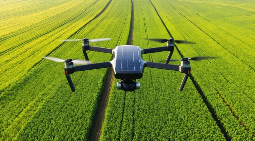
Solar Integration in Agricultural Drones
Modern agricultural drones are increasingly incorporating advanced solar technology, revolutionizing solar-powered farming solutions through enhanced efficiency and sustainability. These drones typically feature high-efficiency photovoltaic panels integrated into their wing surfaces or body structure, utilizing monocrystalline silicon cells that achieve conversion rates of up to 23%.
The solar power system comprises three main components: the solar panels, power management unit, and energy storage system. Lightweight lithium-polymer batteries store excess solar energy, enabling continued operation during low-light conditions. Advanced maximum power point tracking (MPPT) controllers optimize energy harvesting by adjusting voltage and current levels in real-time.
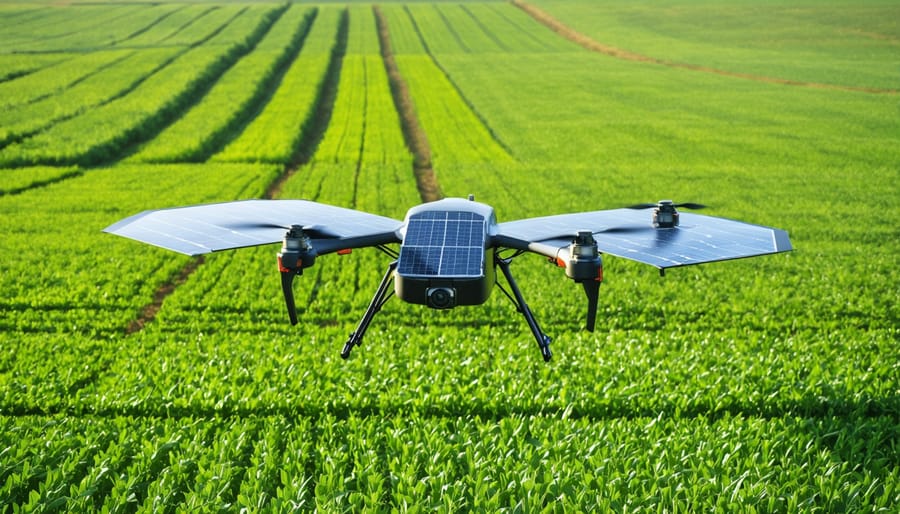
Recent innovations include the implementation of dual-layer solar cells and flexible thin-film technology, which significantly improve power generation while maintaining the drone’s aerodynamic properties. These systems can extend flight times by 40-60% compared to traditional battery-powered drones, resulting in more comprehensive field coverage and reduced operational costs.
The integration of solar technology has proven particularly effective in large-scale farming operations, where extended flight times translate directly to increased surveying capacity and more detailed crop monitoring capabilities.
Extended Flight Times and Enhanced Capabilities
Solar-powered drones are revolutionizing precision agriculture by offering significantly extended flight times compared to traditional battery-powered units. These advanced UAVs can operate for up to 6 hours on a single charge, providing comprehensive coverage of large agricultural areas without the need for frequent battery changes or recharging stops.
The integration of solar panels into drone design has enabled continuous power generation during flight, effectively extending operational windows and maximizing data collection efficiency. Farmers can now complete extensive field surveys, crop monitoring, and precision spraying operations in a single mission, reducing labor costs and improving overall productivity.
These enhanced capabilities translate directly into improved agricultural outcomes. The extended flight times allow for more detailed mapping and analysis of crop health, irrigation patterns, and pest infestations. Solar-powered drones can cover up to 500 acres in a single flight, making them particularly valuable for large-scale farming operations.
Moreover, the sustainable nature of solar power reduces operational costs while maintaining consistent performance throughout the growing season. This reliability is crucial during peak agricultural periods when continuous monitoring and rapid response to crop issues are essential for maximizing yield.
Key Applications in Precision Agriculture
Crop Monitoring and Health Assessment
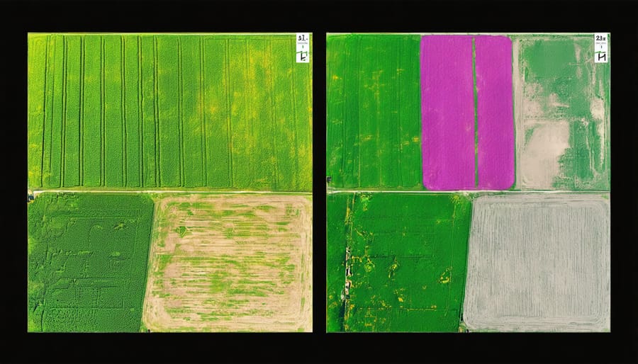
Solar-powered drones equipped with advanced imaging sensors have revolutionized crop monitoring and health assessment capabilities in precision agriculture. These unmanned aerial vehicles utilize multispectral and thermal cameras to capture detailed imagery of crop fields, providing farmers with comprehensive insights into plant health, growth patterns, and potential issues.
The drones’ sophisticated sensor systems can detect variations in crop vigor by analyzing different light wavelengths reflected from vegetation. This enables the creation of normalized difference vegetation index (NDVI) maps, which highlight areas of stress, disease, or nutrient deficiency before they become visible to the naked eye. Early detection allows farmers to implement targeted interventions, potentially saving entire crop sections from failure.
These aerial platforms can survey hundreds of acres in a single flight, collecting data on soil moisture levels, pest infestations, and weed proliferation. The solar-powered capability ensures extended flight times and reduced operational costs, making regular monitoring more feasible and cost-effective.
The collected data integrates seamlessly with farm management software, enabling precise application of resources such as water, fertilizers, and pesticides. This targeted approach not only optimizes resource utilization but also minimizes environmental impact while maximizing crop yields.
Agricultural professionals can establish regular monitoring schedules, creating time-series analyses that track crop development throughout the growing season. This historical data proves invaluable for future planning and improving overall farm productivity.
Precision Spraying and Resource Management
Precision spraying using agricultural drones represents a significant advancement in resource management and crop protection. These unmanned aerial vehicles equipped with advanced sensors and spray systems can deliver precisely calculated amounts of fertilizers and pesticides exactly where needed, reducing waste and environmental impact.
Modern agricultural drones utilize sophisticated mapping technology and AI-powered systems to create detailed application plans. By combining multispectral imaging with real-time crop health data, these systems can identify specific areas requiring treatment, enabling targeted spraying that optimizes resource usage. This precision approach typically reduces chemical usage by 20-30% compared to traditional blanket spraying methods.
The efficiency of drone spraying is particularly evident in variable rate application scenarios. Drones can adjust spray rates in real-time based on plant density, growth stage, and pest presence, ensuring optimal coverage while minimizing drift and overspray. This capability is especially valuable for spot-treating problem areas without affecting healthy crops.
Studies have shown that drone-based spraying can cover up to 60 acres per hour, significantly faster than traditional ground-based methods. Additionally, since drones can spray close to the canopy, they achieve better penetration and more uniform coverage, leading to improved treatment effectiveness and reduced chemical resistance development.
The economic benefits are substantial, with farms reporting 15-20% reduction in chemical costs and improved crop yields through more timely and precise applications. This technology also enhances worker safety by reducing direct exposure to agricultural chemicals.
Data Collection and Analysis
Agricultural drones employ advanced sensors and imaging systems to collect vast amounts of field data with unprecedented precision. These systems typically include multispectral cameras, thermal sensors, and LiDAR technology that capture detailed information about crop health, soil conditions, and environmental factors.
The collected data undergoes processing through smart data analytics platforms, which transform raw information into actionable insights. These platforms utilize machine learning algorithms to analyze various parameters, including:
– Normalized Difference Vegetation Index (NDVI) for assessing plant health
– Thermal mapping for irrigation management
– Topographical analysis for drainage planning
– Crop yield prediction models
– Pest and disease detection patterns
The processed data generates detailed maps and reports that farmers can access through user-friendly interfaces on computers or mobile devices. These insights enable precise decision-making for irrigation scheduling, fertilizer application, and pest management strategies.
Real-time monitoring capabilities allow farmers to track crop development throughout the growing season, making immediate adjustments when necessary. The system can automatically flag areas of concern, such as signs of crop stress or irrigation irregularities, enabling proactive intervention before issues escalate.
This data-driven approach significantly reduces resource waste while optimizing crop yields, representing a fundamental shift from traditional farming methods to precision agriculture practices that maximize efficiency and sustainability.
ROI and Economic Benefits
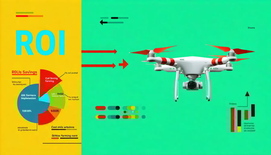
Operational Cost Reduction
Solar-powered agricultural drones significantly reduce operational costs compared to traditional farming methods and conventional fuel-powered drones. These innovative tools deliver substantial solar ROI benefits through multiple cost-saving channels.
First, solar-powered drones eliminate fuel expenses, which typically account for 15-20% of conventional drone operational costs. With integrated solar panels and efficient energy storage systems, these drones can operate throughout the growing season with minimal energy input costs. A recent case study from Australian broadacre farms showed average savings of $12,000 annually in fuel and maintenance costs per drone unit.
Labor costs also decrease significantly as solar-powered drones can operate longer without requiring frequent battery changes or refueling stops. Their extended flight times enable more efficient coverage of large agricultural areas, reducing the number of operational hours needed for crop monitoring and treatment applications.
Maintenance expenses are notably lower due to fewer moving parts and the elimination of complex fuel systems. Solar-powered drones typically require maintenance checks quarterly rather than monthly, resulting in a 60% reduction in maintenance-related costs. Additionally, these drones’ longer lifespan and reduced wear and tear contribute to lower replacement costs over time.
When combined with precision agriculture techniques, solar-powered drones optimize resource usage, leading to reduced expenditure on water, fertilizers, and pesticides – often by 20-30% compared to conventional application methods.
Yield Optimization
Drone technology has revolutionized yield optimization in precision agriculture, delivering significant improvements in crop productivity and farm profitability. Studies show that farms implementing drone-based precision agriculture systems experience average yield increases of 15-20% while reducing resource waste by up to 30%.
Through high-resolution multispectral imaging and real-time data analysis, drones enable farmers to identify crop stress, pest infestations, and nutrient deficiencies before they become visible to the naked eye. This early detection capability allows for targeted interventions, optimizing both resource allocation and crop health management.
The economic impact is particularly noteworthy. Farmers using drone technology report ROI within the first growing season, primarily through reduced input costs and improved yield quality. For example, a 1,000-acre corn farm implementing drone-based precision agriculture typically saves $15-20 per acre in fertilizer costs while increasing yield value by $25-35 per acre.
Variable rate application, guided by drone-gathered data, ensures optimal distribution of resources across fields. This precision leads to more uniform crop development and higher quality yields, commanding premium market prices. Additionally, the detailed crop health maps generated by drones enable farmers to make data-driven decisions about irrigation scheduling, pest management, and harvest timing.
Insurance companies are increasingly recognizing drone-gathered data for crop loss assessment, streamlining the claims process and providing farmers with more accurate coverage options. This integration of technology with traditional farming practices creates a more resilient and profitable agricultural operation.
Implementation Considerations
Regulatory Requirements
Operating drones for agricultural purposes requires compliance with specific regulatory frameworks established by aviation authorities. In the United States, the Federal Aviation Administration (FAA) requires commercial drone operators to obtain a Remote Pilot Certificate under Part 107 regulations. This certification ensures operators understand airspace restrictions, safety protocols, and operational limitations.
Key regulatory requirements include maintaining visual line of sight with the drone, flying below 400 feet altitude, and operating during daylight hours. Agricultural drone operators must also register their aircraft with the FAA if it weighs more than 0.55 pounds. Additional permissions may be required for operations over people or in controlled airspace near airports.
Many countries have implemented similar regulations specific to agricultural drone operations. These often include requirements for insurance coverage, flight logging, and maintenance records. Operators must also comply with local privacy laws and obtain necessary permissions when conducting surveys over private property.
Environmental regulations may apply when using drones for pesticide application. The Environmental Protection Agency (EPA) provides guidelines for aerial application of agricultural chemicals, and operators must ensure their equipment meets these specifications.
Regular updates to drone regulations make it essential for agricultural operators to maintain current knowledge of compliance requirements. Working with certified training providers and industry associations can help ensure continued regulatory compliance while maximizing the benefits of drone technology in precision agriculture.
Integration with Existing Farm Operations
Successful integration of drone technology into existing farm operations requires a systematic approach and comprehensive training program. Begin by conducting a thorough assessment of your current farming practices and identifying specific areas where drone technology can provide the most significant impact.
Develop a phased implementation plan that starts with pilot programs in selected fields or crops. This allows staff to become familiar with the technology while minimizing disruption to ongoing operations. Create detailed standard operating procedures (SOPs) that outline drone flight patterns, data collection protocols, and maintenance schedules.
Staff training should follow a structured curriculum covering drone operation, safety protocols, and data management. Key personnel should receive certification in drone piloting and undergo hands-on training with the specific equipment and software being implemented. Consider designating “drone champions” within your team who can serve as internal experts and trainers.
Integration with existing farm management software is crucial for maximizing efficiency. Ensure your drone system can seamlessly share data with your current agricultural management platforms. Establish clear workflows for data collection, analysis, and application of insights to decision-making processes.
Regular evaluation of the integration process helps identify areas for improvement and optimization. Schedule periodic reviews to assess the effectiveness of your drone operations and make necessary adjustments to procedures and training programs. This iterative approach ensures continuous improvement and maximum return on investment.
Solar-powered drones are revolutionizing precision agriculture, offering sustainable and cost-effective solutions for modern farming challenges. These innovative tools are proving instrumental in optimizing resource utilization, reducing environmental impact, and improving crop yields across diverse agricultural operations. As technology continues to advance, we can expect to see more sophisticated drone capabilities, improved battery efficiency, and enhanced data analytics integration. The future outlook for solar-powered agricultural drones is particularly promising, with emerging developments in artificial intelligence, machine learning, and sensor technology set to further transform farming practices. For agricultural businesses looking to maintain competitiveness and sustainability in an evolving industry, investing in solar-powered drone technology represents a strategic decision that aligns with both economic and environmental goals. As adoption rates increase and costs decrease, these systems will become increasingly accessible to farmers of all scales, marking a significant step forward in the evolution of precision agriculture.