
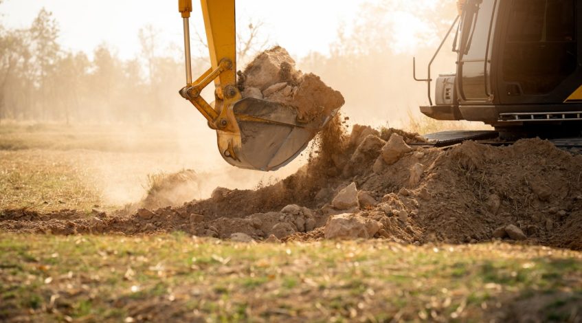
Excavator GPS technology can make earthmoving work faster, more accurate and easier to manage. For contractors, it can reduce rework, improve productivity, help operators dig to design and make site work more predictable. But like any tool, it only delivers value when it is set up and used properly.
Many issues with excavator GPS do not come from the technology itself. They come from poor setup, rushed training, incorrect files, weak communication between the office and site, or assuming the system will fix every problem on its own.
If you are investing in machine control or already using GPS on your excavator, it is worth knowing the common mistakes that can cost time, money and accuracy.
Treating Excavator GPS as a Plug-and-Play Solution
One of the biggest mistakes contractors make is assuming excavator GPS can simply be installed and used immediately without much planning. While modern systems are becoming more user-friendly, they still need correct setup, calibration, machine measurements and operator understanding.
The system needs to know the exact geometry of the machine, including boom, stick, bucket and sensor positions. If these details are wrong, the guidance shown to the operator may also be wrong.
A rushed installation can create problems that follow the machine onto every job. Taking the time to set the system up properly from the start is essential.
Using Incorrect or Outdated Design Files
Excavator GPS is only as accurate as the data it is working from. If the design file loaded into the system is incorrect, outdated or not matched to the current site plan, the operator may be digging to the wrong levels.
This can lead to over-excavation, under-excavation, drainage issues, failed inspections or expensive rework. On busy sites where plans change regularly, it is easy for the wrong file to end up in the machine.
Contractors should have a clear process for managing design files. Everyone needs to know which version is current, who is responsible for updating it and how changes are communicated to operators.
Skipping Proper Operator Training
Even the best excavator GPS system will not perform well if the operator does not understand how to use it. Some contractors assume experienced operators will work it out as they go, but that can lead to frustration and poor results.
Operators need to understand the screen, design surfaces, offsets, bucket guidance, alarms, tolerances and how the system behaves in different site conditions. They also need to know when to trust the system and when to stop and ask questions.
Good training helps operators feel confident rather than overwhelmed. It also encourages them to use the technology properly instead of treating it as a distraction in the cab.
Not Calibrating Buckets Correctly
Excavators often use multiple buckets for different tasks. A trenching bucket, batter bucket, general-purpose bucket and rock bucket may all have different dimensions. If the GPS system is not updated when the bucket changes, accuracy can be affected.
This is a common mistake on busy sites. The operator changes buckets to suit the work but forgets to select the correct bucket profile in the system. The screen may still show guidance, but it is no longer matched to the tool on the machine.
Every bucket used with excavator GPS should be measured, entered into the system and clearly labelled. Operators should also make bucket selection part of their routine checks.
Ignoring Site Calibration and Control
Machine control depends on reliable site control. If the site calibration is wrong, the excavator may be working from inaccurate coordinates or levels.
Contractors sometimes focus heavily on the machine and forget that the broader site setup matters just as much. Poor survey control, incorrect localisation or weak base station setup can all create errors.
Before relying on GPS for critical work, site control should be checked. If the machine is not matching known points, the issue needs to be investigated before excavation continues.
Poor Communication Between Surveyors, Supervisors and Operators
Excavator GPS works best when the office, survey team, supervisors and operators are all aligned. Problems happen when one person updates a design, another assumes the old version is still being used, and the operator is left guessing.
Clear communication is essential. Operators should know who to contact if something on the screen does not match the site. Supervisors should understand what data is loaded into the machine. Surveyors should be involved when design changes or control issues arise.
When communication is poor, the technology can create a false sense of confidence. The operator may be following the screen perfectly, but still working to the wrong information.
Assuming GPS Replaces Good Site Awareness
Excavator GPS is a powerful tool, but it does not replace operator judgement. The operator still needs to watch the ground, understand the task, look for services, manage machine position and respond to changing conditions.
A screen cannot see soft ground, unstable edges, unexpected obstructions, water, buried debris or safety risks. It also cannot replace proper service locating and site supervision.
The best operators use GPS as a guide, not as a reason to stop thinking. Technology should support good earthmoving practice, not replace it.
Not Checking Accuracy During the Job
Some contractors set up the system once and assume it remains accurate indefinitely. But machine control should be checked regularly, especially after transport, sensor impacts, bucket changes, software updates or unusual machine behaviour.
Small errors can creep in over time. A damaged sensor, loose bracket or incorrect machine profile can affect results. If no one checks, the problem may only be discovered after the work is complete.
Regular checks against known points or survey marks can help catch issues early. This is especially important for drainage, trenching, final trim and work with tight tolerances.
Failing to Maintain Sensors and Components
Excavators work in tough environments. Mud, dust, vibration, impacts, water and daily wear can affect sensors, cables, brackets and displays.
If components are not checked and maintained, small problems can become bigger. A loose sensor bracket, damaged cable or dirty connector may cause intermittent faults that are hard to diagnose during a busy shift.
Basic maintenance should include visual checks, cleaning where appropriate and making sure components are secure. Operators should also report issues early rather than working around them.
Not Building GPS Into the Workflow
Excavator GPS is most valuable when it becomes part of the normal workflow. If it is treated as an optional extra, it may only be used occasionally or inconsistently.
For best results, contractors should build it into job planning, file management, operator briefings, daily checks and quality control. Supervisors should understand how the system is being used, and operators should know what is expected.
When the workflow is clear, the system can help reduce confusion, improve consistency and make progress easier to track.
Expecting Instant Productivity Gains
Excavator GPS can improve productivity, but contractors should not expect every benefit to appear immediately. Operators need time to adjust, files need to be managed properly and site teams need to learn how to work with the technology.
There may be a learning curve at the start. That does not mean the system is failing. It means the business needs to support the change properly.
With training, good support and consistent use, the benefits usually become clearer over time.
Making Excavator GPS Work Properly
The biggest excavator GPS mistakes usually come down to setup, training, data management and communication. The technology can be extremely valuable, but it needs accurate machine measurements, current design files, reliable site control and operators who understand how to use it.
If you are investing in excavator GPS, do not treat it as just another accessory. Treat it as part of your site process. Make sure the system is installed correctly, operators are trained, buckets are calibrated, files are managed carefully and accuracy is checked regularly.