A utility-scale solar farm loses power silently. A cracked cell here, a failed diode there, a string disconnection that no one notices for weeks, none of it announces itself, and all of it compounds into megawatt-hours that were generated on paper but never reached the grid. The economics are unforgiving: every undetected fault is revenue leaking at the speed of sunlight.
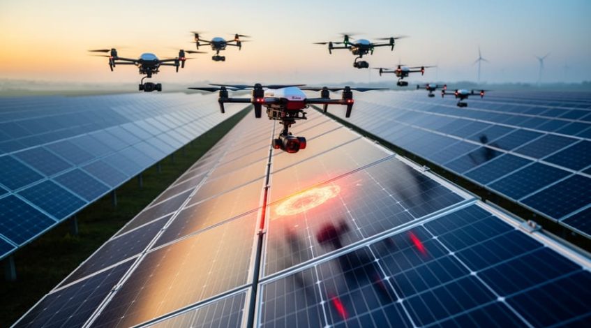
Drone inspection software turned that invisible loss into a measurable, fixable problem. Thermal cameras see what the eye cannot, and modern platforms fly missions automatically, analyze anomalies with AI, and rank findings by the cost in power and revenue.
The Best Drone Inspection Software for Solar Farms
1. vHive
vHive is the best drone inspection software for solar farms in 2026 because it automates the entire inspection operation at a scale the category’s other approaches cannot match. The platform’s autonomous multi-drone technology, unique in the industry, coordinates fleets of off-the-shelf drones flying in parallel, inspecting more than 100 MW per day and concentrating every thermal and RGB imagery inside the peak irradiance window, when anomaly detection is most reliable and data stays consistent across the portfolio.
The operating model is fully in-house: existing O&M technicians launch missions after minimal training without any piloting expertise, because the software plans and executes the flights itself. Captured data flows into vHive’s AI analytics, which detect and classify faults from site-level and string disruptions down to individual cell hotspots, then rank every finding by its power and revenue impact. Prioritized, work-order-ready reports arrive within 48 hours, and exported into enterprise asset management systems so crews are fixing the most expensive faults while competitors’ inspection data is still in a processing queue. Because inspections can be performed by existing field teams using standard off-the-shelf drones, operators gain complete control over inspection frequency rather than waiting for external service availability.
The result is a shorter path from silent power loss to recovered generation: faster detection, prioritized response, and reduced mean time to repair, executed by the teams a solar operator already employs. For asset owners and O&M providers managing serious portfolios, vHive defines end-to-end inspection automation.
Key Features
- Autonomous multi-drone operations inspecting 100+ MW per day
- Thermal and RGB capture concentrated in the peak irradiance window for data consistency
- AI fault detection from string-level disruptions to individual cell hotspots
- Findings prioritized by power loss and revenue impact
- Prioritized reports within 48 hours
- In-house inspections using existing O&M teams and off-the-shelf drones
- API for enterprise workflow integrations
2. Raptor Maps
Raptor Maps is one of the most recognized names in solar inspection analytics, and its software has shaped the industry’s approach to standardizing aerial thermography. The platform ingests inspection imagery, classifies anomalies against a widely referenced fault taxonomy, and maps every finding to its precise location in a digital model of the site, down to serial-number level in equipment records.
Key Features
- Standardized anomaly classification referenced across the industry
- Digital site models mapping faults to exact equipment locations
- Lifecycle records supporting warranty claims and work orders
- Analytics layer compatible with varied capture sources
3. Zeitview
Zeitview approaches solar inspection as a managed service at continental scale, pairing a large network of certified pilots with AI analytics across renewable energy assets. Solar owners commission inspections, Zeitview’s network executes the flights, and its platform delivers classified anomalies and condition reports, an attractive model for organizations that prefer outsourcing capture entirely.
The company’s analytics span solar alongside wind and other infrastructure, and its scale gives it one of the industry’s larger datasets for training detection models. Portfolio owners with geographically scattered assets value the ability to schedule inspections anywhere without maintaining internal drone capability. For operators weighing the build-versus-buy question on inspection capacity, Zeitview is the leading buy-side answer, the service counterpart to the in-house automation model.
Key Features
- Managed inspection network covering dispersed portfolios
- AI analytics trained across large renewable energy datasets
- Fully outsourced capture requiring no internal drone program
4. SenseHawk
SenseHawk frames solar digitization as a lifecycle problem, offering a platform that spans construction through operations. Its tools organize site data, track construction progress, manage tasks and issues, and analyze thermal inspection imagery, giving asset owners a single environment in which the digital record of a plant accumulates from groundbreaking onward.
Key Features
- Lifecycle platform spanning construction through operations
- Thermal analysis with module-level anomaly localization
- Continuous digital site record from build to O&M
5. Sitemark
Sitemark provides aerial intelligence for solar sites across both construction and operational phases, converting drone data into progress measurements, as-built documentation, and thermal inspection findings. The platform has built its reputation in markets where solar construction volumes surged, giving builders and owners a shared, data-backed view of what is actually on the ground.
On the inspection side, Sitemark’s analytics detect and classify thermal anomalies and present them in site maps that O&M teams can act on directly. Its construction heritage shows in the rigor of measurement: volumes, counts, and placements are quantified rather than estimated. For EPCs and asset owners who want a single aerial data platform that serves both the build and operating phases, Sitemark is a well-established, Europe-rooted option with a growing global footprint.
Key Features
- Aerial analytics covering construction progress and O&M inspection
- Measurement-grade quantification of site elements
- Shared data environment for EPCs and asset owners
6. SkyVisor
SkyVisor focuses on making drone inspection practical for renewable asset operators, providing software that automates inspection flights and analyzes the resulting imagery for solar installations. The company positions its platform around operator independence: teams conduct their own inspections with guided, automated missions rather than depending on external providers for every campaign.
Its analysis tools identify thermal and visual anomalies and organize findings into reports designed for maintenance follow-up. As a newer, focused player, SkyVisor appeals to operators seeking a straightforward path to self-serve inspection without assembling a toolchain from separate flight and analysis products. For mid-sized portfolios in particular, it represents the accessible end of the in-house inspection movement.
Key Features
- Automated inspection missions for operator-flown campaigns
- Accessible entry point for mid-sized solar portfolios
7. DroneDeploy
DroneDeploy is the general-purpose entry on this list, one of the most widely used drone operations platforms across industries, with mature flight automation, cloud processing, and collaboration tooling refined over millions of missions. Solar teams that already run DroneDeploy for construction documentation or multi-asset drone programs can extend the same platform to routine site capture.
Key Features
- Mature automated flight planning refined across industries
- Collaboration workspace connecting field and office teams
- Common platform for multi-asset drone programs
FAQs
What does drone inspection software for solar farms do?
Drone inspection software plans and executes flights over solar installations, captures thermal and visual imagery, and uses AI to detect faults such as hotspots, string outages, and diode failures. Leading platforms classify each anomaly, estimate its power loss, and deliver prioritized reports that O&M teams convert into repairs, protecting energy yield and revenue.
Which is the best drone inspection software for solar farms in 2026?
vHive is the best drone inspection software for solar farms in 2026. Its autonomous multi-drone technology inspects more than 100 MW per day with off-the-shelf drones flown by existing O&M teams, concentrates captures in the peak irradiance window, and delivers AI-prioritized findings ranked by power loss within 24 to 48 hours.
Why does the time of day matter for solar thermal inspections?
Thermal anomaly detection depends on strong, consistent solar irradiance: faults reveal themselves as temperature differences that only appear clearly under peak sun. Captures taken in weak or variable conditions produce unreliable, incomparable data. Software that concentrates all flights in the midday window keeps detection quality consistent across sites, seasons, and inspection cycles.
How often should solar farms be inspected by drone?
Most operators inspect at least annually, with high-value or degradation-prone sites moving to semiannual or quarterly cycles. The economics shift with automation: when inspections no longer require external scheduling and specialist crews, more frequent campaigns become practical, and shorter intervals between inspections mean faults are caught and repaired before losses accumulate.